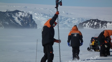
Dr Wolfgang Rack of Gateway Antarctica explains the link between sea ice thickness and global climate and how he uses the CryoSat-2 satellite to measure sea ice.
Jargon alert
Freeboard is the height of the ice above sea level.
Transcript
DR WOLFGANG RACK
So I’m involved in the mass balance measurement of land ice and sea ice, and here we deal with ice thickness measurements, which we relate to freeboard measurements, and this is the same principle for sea ice and land ice. So we would like to measure what sticks out of the water and relate that to the total ice thickness.
When we are talking about land ice, the thickness of the ice and the change of the thickness is related to sea level change. So we would like to know the mass balance of the ice sheet, so if the ice sheet shrinks then the sea level is automatically rising, and for the sea ice, its relation to global climate because sea ice is a very important component in the global climate, because it very effectively reflects incoming solar radiation back to space, and it effectively seals off the warm ocean from the very cold atmosphere in the very cold polar climate.
So the satellite measures sea ice thickness by measuring the freeboard, and we relate that amount of freeboard to the total ice thickness by using assumptions on the ice density. We use satellites because satellites can measure large areas and because Antarctic sea ice at the maximum extent is about 20 million square kilometres, which is absolutely impossible to measure with local measurements.
CryoSat was built to measure surface elevation, and the way the satellite is doing this is using an advanced version of the radar altimeter, and this radar altimeter transmits a radar signal which is reflected by the Earth’s surface and received by the satellite, and it measures the time from the transmission to receiving that signal at the satellite. So at the end, it’s a measurement of distance between the satellite and the Earth’s surface, and that time is related to the distance.
The accuracy of the satellite measurement needs to be very high, and this is very demanding because sea ice freeboard is actually very small – sometimes not more than 20 or 30 centimetres. So to get the accurate distance, the position of the satellite is very, very important, and there is a second instrument on CryoSat which actually determines very accurately the position of the orbit so that the surface elevation measurement is at an accuracy of 10 centimetres and below.
Acknowledgements:
Daniel Price, University of Canterbury
International Polar Foundation
NIWA
Cryosat II footage courtesy of European Space Agency/ESA


