Artificial sensors and probes enable us to overcome the limitations of our human senses and extend them in novel and useful ways, using the scientific concepts of electricity and waves. Find out ...
Monitoring our world using artificial sensors Artificial sensors enable us to overcome the limitations of our human senses and extend them in novel and useful ways, using the scientific concepts ...
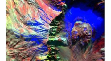
Using super sense technology, changes in the Earth’s structure can be measured without having to actually be there: Motion sensors called seismographs record tremors or small earthquakes that ...
The series of activities described below was designed to help students develop an understanding about earthquakes in New Zealand, including why we get them and how we measure them. The world of ...
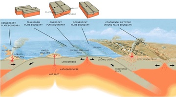
In this activity, students take on the roles of seismologists, vulcanologists and geographers, using maps to look for patterns in the worldwide distribution of earthquakes, volcanoes and ...
In this activity, students use maps to plot a graph of earthquakes under New Zealand to show the shape of the North Island subduction zone and compare this to the distribution of earthquakes in ...
Large snow events in most parts of New Zealand are uncommon. However, if you are in the South Island or the central North Island, this citizen science project could be a great one for your ...
Globe at Night is an international citizen science campaign to raise public awareness of the impact of light pollution by inviting citizen scientists to measure and submit their night sky ...
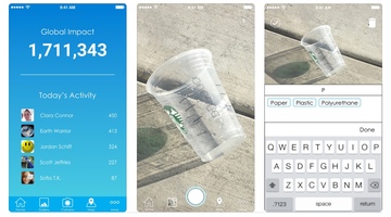
Litter is everywhere – but how much is there, and why does it matter? Litterati is an online citizen science (OCS) project that allows participants to photograph, upload and tag litter in their ...
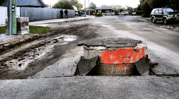
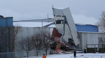
About 14,000 earthquakes are recorded in and around Aotearoa New Zealand every year. Canterbury’s 7.1 and Kaikōura's 7.8 magnitude earthquakes and subsequent aftershocks show the constant threat ...
This online PD session, recorded on 18 February 2015, focuses on using Science Learning Hub earthquake resources to plan an Earth and Space science unit. It models how a variety of resources can ...
Children’s involvement in science is increased when they have an opportunity to make decisions about science-based issues that have consequences for their lives. It’s bringing science into the ...
Professor Richard Haverkamp of Massey University gives an introduction to how the famous 19th century scientist Michael Faraday made an early step towards nanoscience.
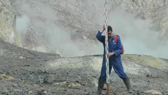
All the volcanoes in New Zealand are monitored for activity so that scientists can determine when the next eruption might be. Dr Jan Lindsay introduces us to the monitoring system and how it ...
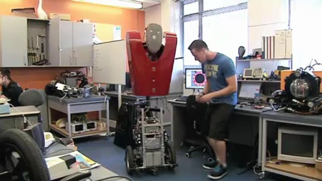
Professor Dale Carnegie and his team at Victoria University have spent many years developing a Mobile Autonomous Robotic Vehicle for Indoor Navigation – or MARVIN for short. This robot does many ...
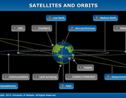
The size, orbit and design of a satellite depend on its purpose. In this interactive, scientists discuss the functions of various satellites and orbits. Accompanying fact files provide ...
Use this interactive to identify the components of a modern landfill system. Drag and drop the text labels onto the diagram.
This slideshow, from the webinar Digital tools for science learning, provides additional support for the video tutorial. Use the Slideshow menu for further options, including view full screen ...