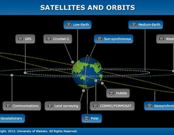
Name: MTSAT-2 (Multi-functional Transport Satellite)
Satellite number: 28937
Owner: Japan
Mission: Earth science, weather, communications, navigation
Launch date: 2006
Type of orbit: geostationary high-Earth orbit
Period: 24 hours
Perigee: 35,777 km
Apogee: 35,797 km
Transcript
Dr Allan McInnes
Weather satellites are, I guess, one of the earliest applications of satellites after communications. The very first satellites were communications satellites. Weather came along afterwards when people said, “Hey, it would be really great if we were a long way above the Earth and could see a lot of it and could see weather patterns developing.”
So weather satellites will be – usually they’re a little bit smaller than a communications satellite, maybe 3, 4 metres on its side, 3 tonnes something like that. Typically what they’re going to be doing is carrying a payload of visible and infrared sensors – so basically cameras that are looking at the Earth either seeing visible light – the stuff that you and I see on a day-to-day basis – or infrared, which lets them see how the temperature of clouds and the ocean and the air is changing, and obviously those temperatures have some effect on how weathers can develop. Then that information will go to meteorologists on the ground who can figure out by looking at the data what the weather’s going to do or at least where the clouds are.


